29.03.2024 Wanderung von Worms mit dem supertollen Nibelungenmuseum über Lampertheim am Rhein nach Kirschgartshausen (Baden) im Google Album
29.03.2024 Wanderung von Worms mit dem supertollen Nibelungenmuseum über Lampertheim am Rhein nach Kirschgartshausen (Baden) im Google Album:
Kleine Impression von einer „Grenzwanderung“ über drei Länder...
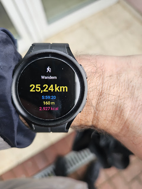
Der Startpunkt war am Wormser Hauptbahnhof 🚆 um 09:42 Uhr mit einem kurzen gang durch Worms bis zum super interessanten Nibelungenmuseum, danach zum Rhein mit dem Hagendenkmal, der Pegeluhr und natürlich der Nibelungenbrücke mit dem super schönen Nibelungenturm. Über die hessische Seite von Lampertheim am Stadtteil Rosenheim vorbei auf dem oberen Rheinhauptdeich Weg Richtung des Lampertheimer Altrheins im Regen ☔ lang gewandert und natürlich den kurzen Abstecher zum Freischärlergrab von 1848 ♱😇 gemacht. Am Altrhein entlang bis nach Kirschgartshausen (Baden) und dort mal geschaut wo mich ©GoogleMaps langführen würde und da ich dort so nie langlaufen wäre mal diesen vorgeschlagenen Weg (immer noch im Regen 🌧) gewandert und dann im Stadtteil Blumenau von Sandhofen-Nord hinter der Coleman Barracks rauszukommen um dann auf dem Weg an der Riedbahnlinie im Stadtteil Schönau herauszukommen und um 15:43 Uhr erst den Schirm 🌂 (endlich) zuzumachen und meine GPS Uhr abzufotografieren.
Die Fotos sind mit dem Smartphone S23 Ultra (SM-S918B) aufgenommen und (fast) nicht bearbeitet worden (außer manche etwas geradegerückt).
29/03/2024 Hiking from Worms with the very great Nibelungenmuseum via Lampertheim on the Rhine to Kirschgartshausen (Baden) in the Google Album:
Small impression of a "border hike" across three countries....
The starting point was at Worms main Train station 🚆 at 09:42 a. m. clock with a short walk through Worms to the very interesting Nibelungenmuseum, then to the Rhine with the Hagendenkmal (Monument), the Pegeluhr (Gauge clock) and of course the Nibelungenbrücke (Bridge) with the very beautiful Nibelungenturm (Tower). We hiked along the Hessian side of Lampertheim past the district of Rosenheim on the upper Rhine main dyke towards the Lampertheim Old Rhine in the rain ☔ and of course made a short detour to the Freischärlergab (Grave) of 1848 ♱😇. Walked along the Old Rhine to Kirschgartshausen (Baden) and there looked where ©GoogleMaps would take me and as I would never have walked there I walked this suggested route (still in the rain 🌧) and then came out in the district Blumenau of Sandhofen-Nord behind the Coleman Barracks and then came out on the way along the Riedbahnlinie (Train railway line) in the district Schönau and at 03:43 p. m. clock closed the umbrella 🌂 (finally) and took a photo of my GPS watch.
The photos were taken with the smartphone S23 Ultra (SM-S918B) and have (almostnot been edited (except some have been straightened a little).
Ein Google Album von der Wanderung am Karfreitag · Album von ©Axel Polsfuss/A Google album from the hike on Good Friday · Album by ©Axel Polsfuss:
.jpg)
.png)


.jpg)
.jpg)
Kommentare
Kommentar veröffentlichen