24.02.2024 12:54 Uhr bis 17:57 Uhr Wandern auf (einigen) ungewöhnlichen neuen Wegen 😋 zum Lindenhof in die Johanniskirche 😇 in komoot (26,5 km)
24.02.2024 12:54 Uhr bis 17:57 Uhr Wandern auf (einigen) ungewöhnlichen neuen Wegen 😋 zum Lindenhof in die Johanniskirche 😇 in komoot (26,5 km):
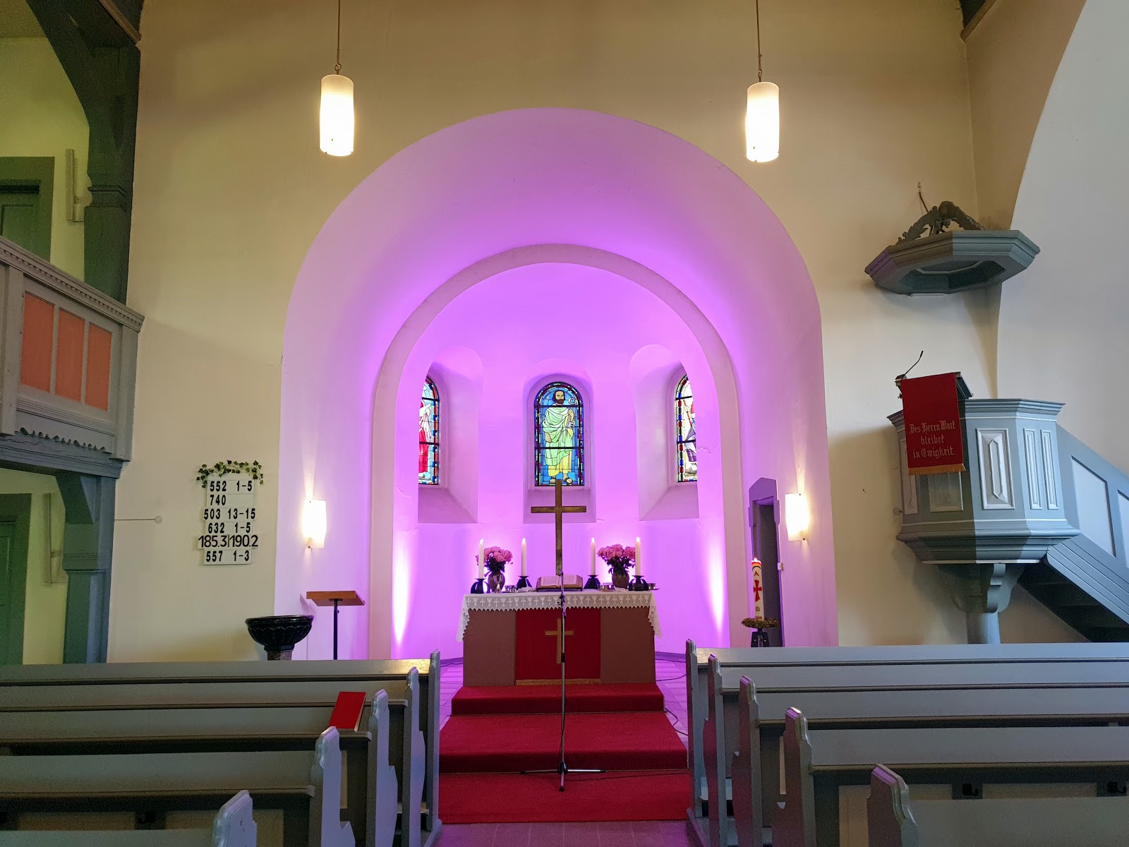
Vom Stadtteil Mannheim-Schönau ein Stück (wie immer) durch den Käfertaler Wald mit dem Karlstern und über die B 38 in den Stadtteil Vogelstang und entlang der Magdeburger Straße (auch bewusst neben der A6) am Stadtteil Wallstadt in Richtung Feudenheim um dort an der A 6 über den Rhein & Rheinkanal weiter zu wandern an der A 6 (gewollt) und an der komoot Wegführung gehalten um etwas bewusst in der “Pampa“ gelaufen – aber war interessant und schön. Dann bei dem Stadtteil Hochstätt über die A656 gelaufen und an der S-Bahn Station Mannheim ARENA / Maimarkt zum Rangierbahnhof zu gelangen und über den Fußsteig rüberzugehen. Im Stadtteil Neckarau am Seilwolff-Center entlang um ein kleines Stück das GKM „zu umgehen“ und dann auf dem Damm über die Parkinsel in Richtung Linderhof zur Johanniskirche gelangen und ja bin grade zur richtigen Zeit für den Ökumenischen Abendgottesdienst (pünktlich) um 🕕 17:57 Uhr anzukommen…
Wetter: 11°C | stark bewölkt, aber sehr schön (hoffe die Bilder zeigen es 😉) | Leichter Wind aus Südwesten (14 km/h) | Luftfeuchtigkeit 69%.
Nach Monaten oder besser Jahren war die Tour tatsächlich mal in komoot geplant gewesen und die Wegführung (z.B. entlang der Autobahn auf kleinen Feldwegen) bin ich dann tatsächlich auch so gelaufen, da ich sonst „frei Schnauzte“ laufe wäre ich (vermutlich) solche Wege nicht gelaufen – aber es ist schon interessant auf welchen Wegen man dann geführt wird.
Alle Fotos sind mit dem Smartphone S23 Ultra (SM-S918B) aufgenommen, komprimiert worden und mit ©Google - Picasa 3 (Auf gut Glück! und die Sättigung erhöht) bearbeitet worden.
-----------------------------------------------------------------------------
24/02/2024 12:54 p. m. clock to 05:57 p. m. clock Hiking on (some) unusual new paths 😋 to the Lindenhof in the Johanniskirche (Church) in komoot (26,5 km/16,5 miles):
From the district Mannheim-Schönau a bit (as usual) through the Käfertaler Wald (Forest) with the Karlstern and over the B 38 (Federal highway) into the district Vogelstang and along the Magdeburger Street (also deliberately next to the A6 (Highway)) at the district Wallstadt towards Feudenheim to continue hiking along the A6 (Highway) over the Rhine & Rhine Canal at the A 6 (Highway) (deliberately) and kept to the komoot route guidance to walk a bit deliberately in the "Pampa" - but was interesting and beautiful. Then walked over the A 656 (Highway) at the district Hochstätt and at the S-Bahn station Mannheim ARENA / Maimarkt to get to the marshalling yard and cross over via the footpath. In the Neckarau district along the Seilwolff Centre to "bypass" the GKM (=Grosskraftwerk Mannheim (Translated: large power station Mannheim) for a short distance and then along the embankment across the Parkinsel (Island) in the direction of Linderhof to the Johanniskirche (Church) and yes, I arrived just in time for the ecumenical church evening service (on time) at 🕕 05:57 p. m. clock...
Weather: 11°C | very cloudy, but very nice (hope the pictures show it 😉) | light wind from the Southwest (14 km/h) | Humidity 69%.
After months or rather years, the tour had actually been planned in komoot and I actually walked the route (e.g. along the motorway on small dirt roads), as I would otherwise have (probably) not walked such paths - but it is interesting on which paths you are then guided.
All photos were taken with the Smartphone S23 Ultra (SM-S918B), compressed and edited with ©Google - Picasa 3 (Auf gut Glück! (On good luck!) and the Sättigung (Saturation increased).
.jpg)
Oft fotografiert: die Schönauer Hütte an der Ahornallee im Käfertaler Wald / Often photographed: the Schönauer Hütte (Refuge) on Ahornallee (Forestway) in Käfertaler Wald (Forest)
.jpg)
.jpg)
Kommentare
Kommentar veröffentlichen